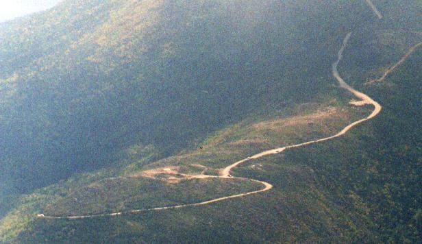
Mt Adams Trip - 21/Sept/96
Map of the trip
After several wet weekends, the good weather forecast was just too
good to pass up. I decided to hike something big, and spend some
quality time above treeline, so I picked Mt Adams and the King
Ravine trail, one of the best trails in the northern Presidentials.
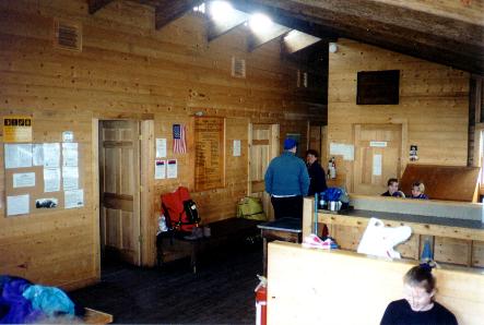
On Friday, I made a call to MRL to get a
bed for the night and cut down on my Saturday driving and away I
went.
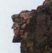 After getting up at 6:00, eating breakfast, and taking a few pics of
the
Old Man of the Mountains, I was at
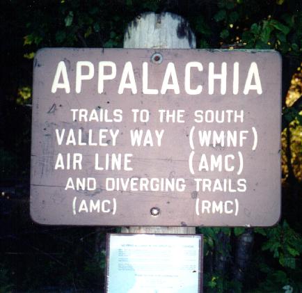
Appalachia by 7:40 and on the
trail before 8:00. The route to King ravine is via the Airline,
Short Line, Randolph Path, back to the Short Line, which connects to
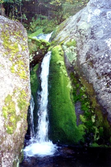
the King Ravine trail at the base of the ravine. Just before there,
among all the illegal camp sites, is
Mossy Falls which is only
about 6' tall but photographs well.
After getting up at 6:00, eating breakfast, and taking a few pics of
the
Old Man of the Mountains, I was at
Appalachia by 7:40 and on the
trail before 8:00. The route to King ravine is via the Airline,
Short Line, Randolph Path, back to the Short Line, which connects to
the King Ravine trail at the base of the ravine. Just before there,
among all the illegal camp sites, is
Mossy Falls which is only
about 6' tall but photographs well.
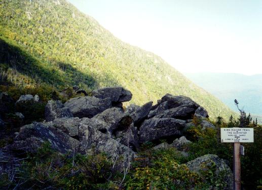
I had only seen three people so far, and was a little worried about
going up the King Ravine trail alone, but I figured someone would
come along eventually and find me if anything went wrong. Not the
most intelligent line of reasoning, but I knew other people would be
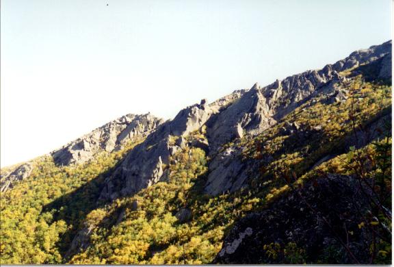
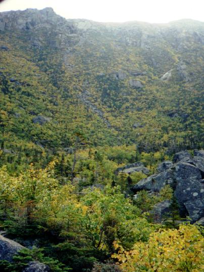
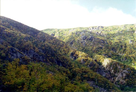
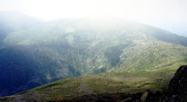
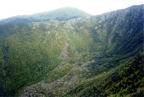
hiking up there that day. I stopped at the
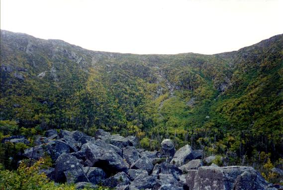
base of ravine and took
in the
huge glacial bowl. Above and to the
west lay
Nowell Ridge
and the RMC's
Crag Camp poking out of the trees. Above and to the
east was Durand Ridge
, home of the Airline trail. I could make out
the Chemin de Dames working its way up. In front, the
King Ravine trail climbs steeply up a slide
and cuts over onto Durand Ridge. On
the far right, the
Great Gully trail could be seen climbing the deep
gash.
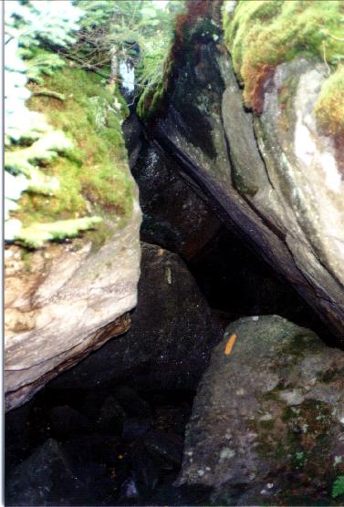
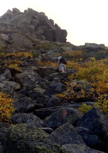
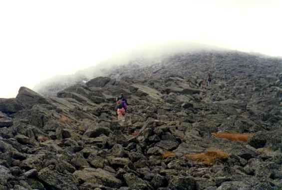
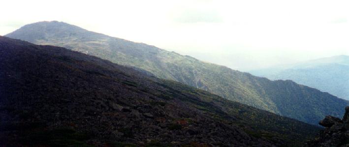
 I could hear the wind howling up top as I started climbing for real.
I took the
Ice Caves loop, scrambling over, under, and
through huge
boulders, before rejoining the main trail in a few 100 yards. Then,
the trail hits the slide and starts gaining serious elevation. About
then I heard people at the base of the ravine and saw someone
closing in on me rapidly, a faster hiker. I rested, ate an apple
and chatted with him a bit before he continued on. I wanted someone
above me so I could get a photo that really showed the
steepness of the trail. Two more folks came into
view below and we hiked in
sight of each other until reaching the
junction with the Airline.
I could hear the wind howling up top as I started climbing for real.
I took the
Ice Caves loop, scrambling over, under, and
through huge
boulders, before rejoining the main trail in a few 100 yards. Then,
the trail hits the slide and starts gaining serious elevation. About
then I heard people at the base of the ravine and saw someone
closing in on me rapidly, a faster hiker. I rested, ate an apple
and chatted with him a bit before he continued on. I wanted someone
above me so I could get a photo that really showed the
steepness of the trail. Two more folks came into
view below and we hiked in
sight of each other until reaching the
junction with the Airline.
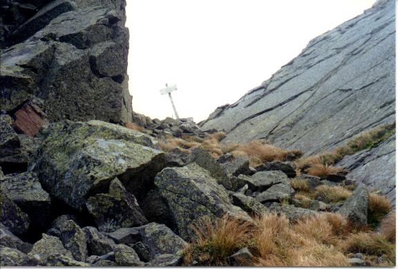
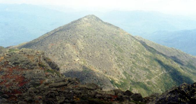
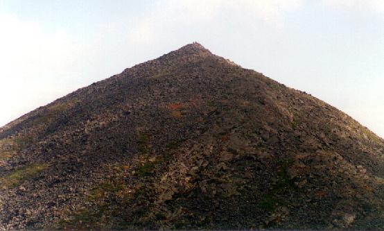
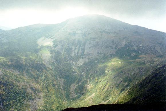
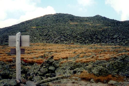
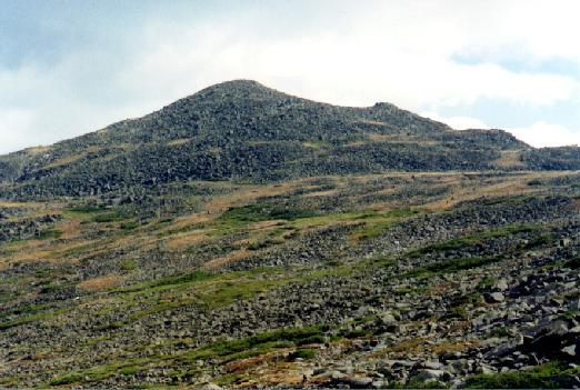
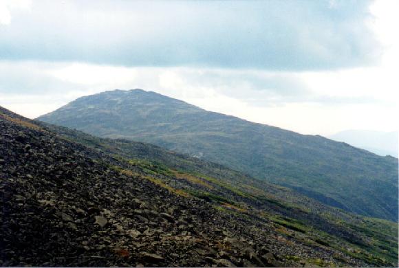
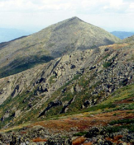
The rest of the trip is exposed and windy. It was
sunny for a
while, but the clouds were constantly blowing over from Castle
Ravine and the summit of Adams was
in and out of the clouds. There
were
nice views towards
Madison, however. Here's a closeup of the
summit. The hut was closed due to a
bit of construction. I got to the summit
around 12:00, put on more clothes, and ate. The views to the east
were not too great, and the
auto
road was out of the clouds most of
the time, but the summits of Washington and
Jefferson never really
came out.
There were lots of people up there, usually around a
dozen with people coming and going every 5 minutes. Lots of folks
were scattered around the summit out of the wind. After about 45
minutes, I headed down towards Thunderstorm Junction.
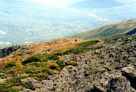
 The trip down was quite solitary, a welcome relief from the crowds up
top. John Quincy Adams looked inviting, but I
chose to contine past Thunderstorm Junction.
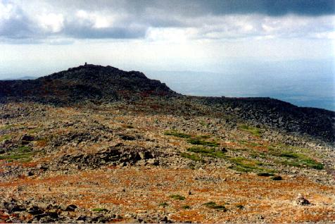
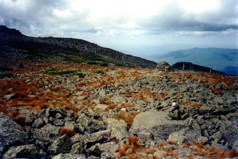
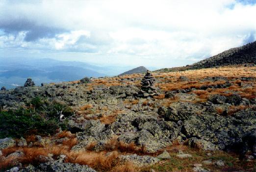
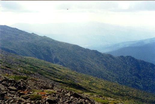
The alpine tundra was just gorgeous. Of course,
as soon as I was far enough away, the summit of Adams
began to clear. I continued to Adams 4, a small
bump on Lowes Path, and the sun was so nice that I stopped and soaked it
up, all by myself. I had great views
back to Adams,
of Jefferson summit,
over to Castilated Ridge,
and
across King Ravine and Durand Ridge. As the
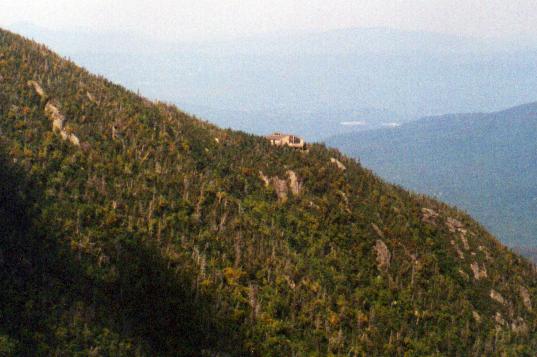
shadows grew on Jefferson I pressed on to
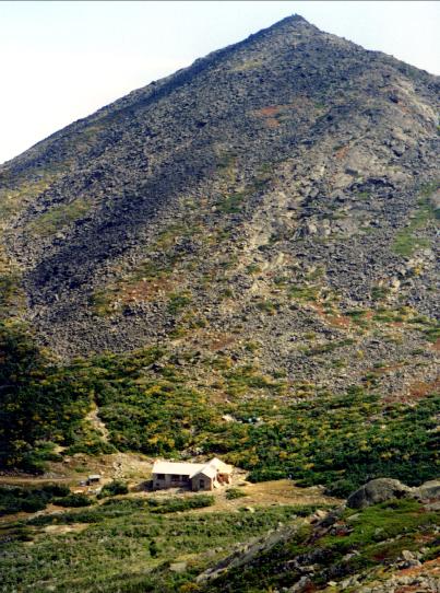
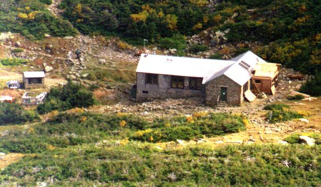
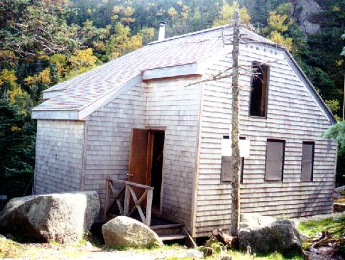
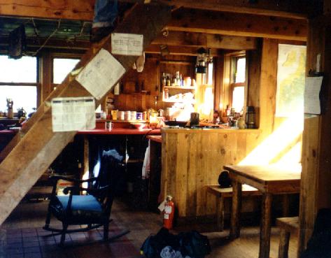
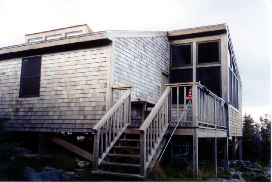
Gray Knob, the RMC winter cabin. I met and
talked with Melissa the caretaker for a while and a took a quick peak
inside. Then I ran over to the new
Crag Camp, just on the edge of
King Ravine. After a last drink of water and
mouthful of chocolate in the
main room it was time to head down. The Spur
trail took me Randolph Path, then I chose the Amphibrach for the final
journey back to Appalachia.
The trip down was quite solitary, a welcome relief from the crowds up
top. John Quincy Adams looked inviting, but I
chose to contine past Thunderstorm Junction.
The alpine tundra was just gorgeous. Of course,
as soon as I was far enough away, the summit of Adams
began to clear. I continued to Adams 4, a small
bump on Lowes Path, and the sun was so nice that I stopped and soaked it
up, all by myself. I had great views
back to Adams,
of Jefferson summit,
over to Castilated Ridge,
and
across King Ravine and Durand Ridge. As the
shadows grew on Jefferson I pressed on to
Gray Knob, the RMC winter cabin. I met and
talked with Melissa the caretaker for a while and a took a quick peak
inside. Then I ran over to the new
Crag Camp, just on the edge of
King Ravine. After a last drink of water and
mouthful of chocolate in the
main room it was time to head down. The Spur
trail took me Randolph Path, then I chose the Amphibrach for the final
journey back to Appalachia.
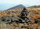
The whole trip took about nine hours, but I spent lots of time resting
and taking photos. There were approximately 30 trail juntions (welcome
to the northern Presidentials), 9 different trails, and lots of great
views.
Back to White Mountains home page