Bonds and Twins Overnight - ??/July/99
Day 1 - The Climb and the Views
Map of day 1.
Elevation chart of day 1.
This trip was a peak bagging mission, to be sure, but it's also one of the most remote
areas in the Whites. We wanted to spend some time up on the Bond ridge. Most of my
time there had been passing through on long day hikes or overnights where I didn't
have time to enjoy the place. So some of us elected to take Friday off from work and
hike up early. This also would allow us to get some places at Guyot Campsite, which
is often overrun on the weekends. Ed and Kathy (and Jobildunk) drove up from Hanover
while Brenda and I came up from Boston, meeting at the WMNF Sugarloaf Campground which
is on the Zealand Road. Nothing special, just a place to pitch a tent, but it allowed
us to get out early the next day.
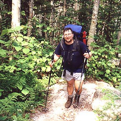
Our start was delayed as we stashed a car a the North Twin trailhead (after I got lost
finding it) then we dropped Ed off at the Hale Brook trailhead. He only had two left
on his 4000'er list, Hale and West Bond. This trip would finish it off for him! The
rest of us continued up to the Zealand trailhead and started in. The first part of
the hike, up to the hut, is pretty flat and we made good time. The view through
Zealand Notch was wonderful, but a little hazy. We
cooled off in the waterfalls and then Brenda and I pressed on,
leaving Kathy at the hut to wait for Ed to loop around on the Lend-a-hand trail.
 The climb from the hut was steep and hot, but we had plenty of
time and water. There were several groups of hikers coming from Galehead to Zealand,
and occasionally we felt like salmon swimming upstream. They all left the hut at
roughly the same time after breakfast and seemed to travel in a pack. By the time we
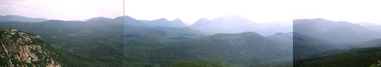
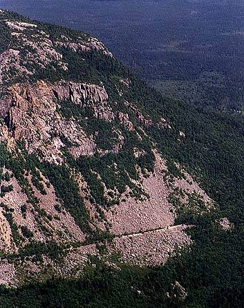
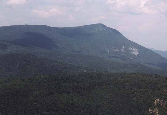
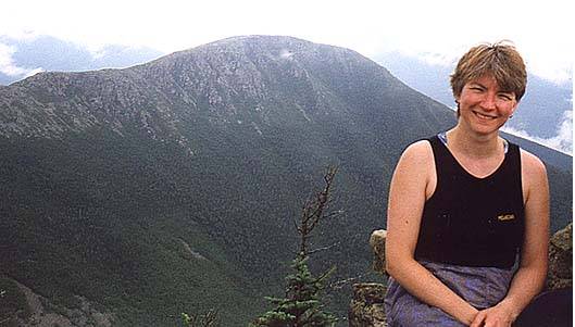
reached Zeacliff, we were ready for a rest. Zeacliff is truly one of the
most spectacular views in the Whites. You're right
opposite Whitewall Mountain, a beautiful slide that has
an old railroad bed running through it carrying the AT. Just
beyond that is the Willey Range; Tom, Field and
Willey. To the south is Carrigain which
will be Brenda's last 4000'er. It's definately a place to
inspire you. We grabbed a relaxed lunch and drank lots of water before pushing
on.
The climb from the hut was steep and hot, but we had plenty of
time and water. There were several groups of hikers coming from Galehead to Zealand,
and occasionally we felt like salmon swimming upstream. They all left the hut at
roughly the same time after breakfast and seemed to travel in a pack. By the time we
reached Zeacliff, we were ready for a rest. Zeacliff is truly one of the
most spectacular views in the Whites. You're right
opposite Whitewall Mountain, a beautiful slide that has
an old railroad bed running through it carrying the AT. Just
beyond that is the Willey Range; Tom, Field and
Willey. To the south is Carrigain which
will be Brenda's last 4000'er. It's definately a place to
inspire you. We grabbed a relaxed lunch and drank lots of water before pushing
on.
 From here the ridge is more gentle, and we climbed through more mixed terrain. We
eventually came to Zealand Pond, just a short spur trail off
the Twinway. We dropped pack and ran down for a bit, then continued to the
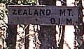
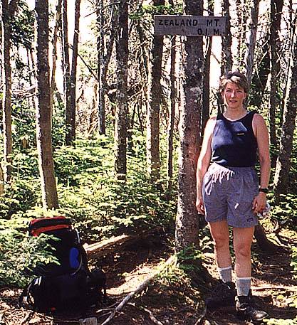
trail junction for Mt Zealand. There's a fair sized cairn
and a sign pointing to a rather narrow and unmaintained spur trail to the
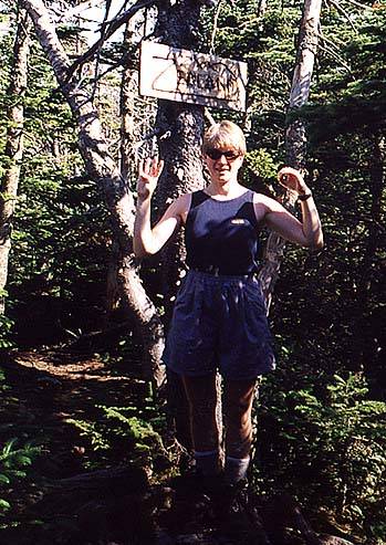
actual summit, whose main feature is a nicely routed sign.
There's no view, no nothing, just a nice quiet spot in the woods. After dropping
a bit of elevation, the trail begins a rocky climb to Mt Guyot.
Although it is over 4000' it doesn't qualify as a 4000'er due to it not rising more
than 200' from the nearest 4000'er.
From here the ridge is more gentle, and we climbed through more mixed terrain. We
eventually came to Zealand Pond, just a short spur trail off
the Twinway. We dropped pack and ran down for a bit, then continued to the
trail junction for Mt Zealand. There's a fair sized cairn
and a sign pointing to a rather narrow and unmaintained spur trail to the
actual summit, whose main feature is a nicely routed sign.
There's no view, no nothing, just a nice quiet spot in the woods. After dropping
a bit of elevation, the trail begins a rocky climb to Mt Guyot.
Although it is over 4000' it doesn't qualify as a 4000'er due to it not rising more
than 200' from the nearest 4000'er.
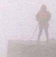
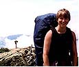
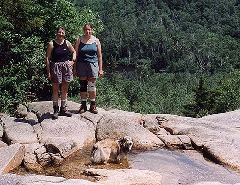
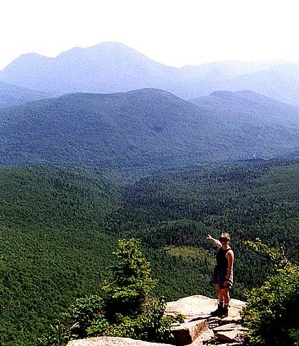
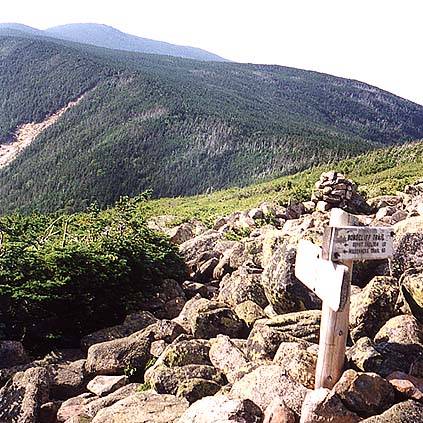
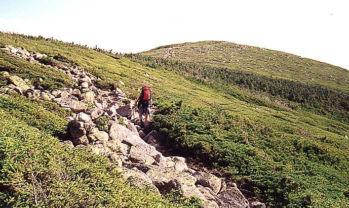
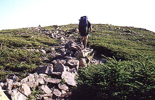
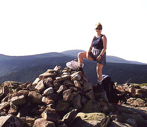
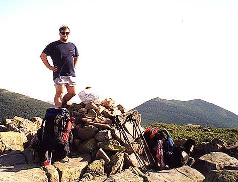
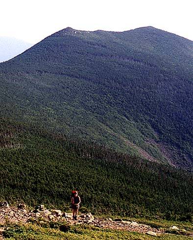
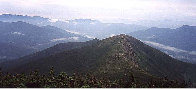
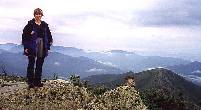
 At the Bondcliff trail junction we were getting out into more
open terrain, especially as you approach the
true summit of Guyot. We took summit photos looking north
and south, then settled in for a spell. There's something about
the summit area of Guyot that always mesmerizes me. It's not a dramatic place, more
subtle than that. You get a sense of being apart from the fray
up there. The weather was holding so we felt no rush to move
on. It was still warm and sunny, and with Guyot Shelter just a mile or so away there
was nothing that made us move on. Eventually a chilly breeze came along and we
decided to push on, make camp, and start in on dinner. The section from Guyot towards
the Bonds is to be savored, not rushed. When we reached the
campsite, all the platforms were taken (4:00 on a Friday!) but the shelter was free.
We staked out four spots for Brenda and me, plus Ed and Kathy, changed out of our
hiking gear, and settle in for the night.
At the Bondcliff trail junction we were getting out into more
open terrain, especially as you approach the
true summit of Guyot. We took summit photos looking north
and south, then settled in for a spell. There's something about
the summit area of Guyot that always mesmerizes me. It's not a dramatic place, more
subtle than that. You get a sense of being apart from the fray
up there. The weather was holding so we felt no rush to move
on. It was still warm and sunny, and with Guyot Shelter just a mile or so away there
was nothing that made us move on. Eventually a chilly breeze came along and we
decided to push on, make camp, and start in on dinner. The section from Guyot towards
the Bonds is to be savored, not rushed. When we reached the
campsite, all the platforms were taken (4:00 on a Friday!) but the shelter was free.
We staked out four spots for Brenda and me, plus Ed and Kathy, changed out of our
hiking gear, and settle in for the night.
Day 2 - The Summits and the Rain
Map of day 2.
Elevation chart of day 2.
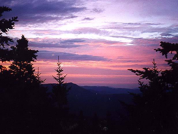
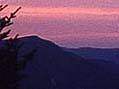 Day 2 dawned with one of the nicest sunrises I've ever
seen from a shelter. But the wonderful colors also meant that there were clouds
in the sky, and the forecast was for rain on and off. But peakbagging is peakbagging,
and there was no thought of not going. Several groups were leaving, so we snagged
three tentsites for us and Ching, Andrew, and Dave who were coming up that day. The
shelter was going to be jammed, and we all prefered the solitude of the tent platforms.
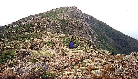
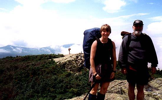
After setting up Brenda and I headed out, with Ed and Kathy to follow. They were
going straight up West Bond to finish Ed's 4000'ers, we were doing Bond and Bondcliff
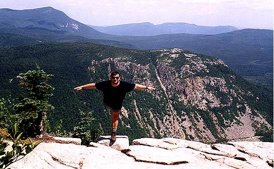
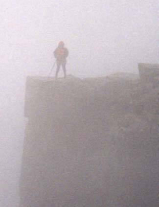
first, expecting to hit West Bond on the way back. It was raining a bit, but we
still had some beautiful and eerie views north towards
Bondcliff. We grabbed a summit photo and continued on hoping
that the weather would hold. But, alas, it didn't. As we
approached the summit (and ate the wonderful blueberries that were in season) the
skies opened up on us. We got a very gray view of the cliffs
themselves and reluctantly turned back. By the time we met up with Ed and Kathy
back on the summit of Bond the rain had stopped and there were
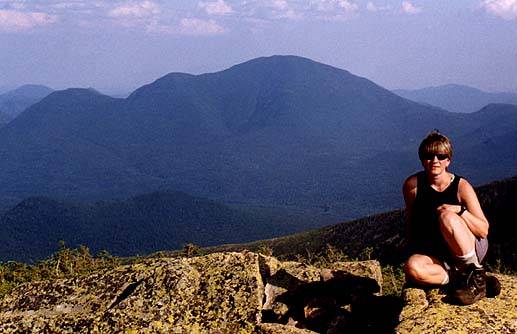
at least some views. Brenda and I headed out to West Bond, which is a short spur
off of the ridge. The summit is just a spike of rock that sticks out above the trees
but it gives a sense of solitude that is hard to get elsewhere
on the ridge.
Day 2 dawned with one of the nicest sunrises I've ever
seen from a shelter. But the wonderful colors also meant that there were clouds
in the sky, and the forecast was for rain on and off. But peakbagging is peakbagging,
and there was no thought of not going. Several groups were leaving, so we snagged
three tentsites for us and Ching, Andrew, and Dave who were coming up that day. The
shelter was going to be jammed, and we all prefered the solitude of the tent platforms.
After setting up Brenda and I headed out, with Ed and Kathy to follow. They were
going straight up West Bond to finish Ed's 4000'ers, we were doing Bond and Bondcliff
first, expecting to hit West Bond on the way back. It was raining a bit, but we
still had some beautiful and eerie views north towards
Bondcliff. We grabbed a summit photo and continued on hoping
that the weather would hold. But, alas, it didn't. As we
approached the summit (and ate the wonderful blueberries that were in season) the
skies opened up on us. We got a very gray view of the cliffs
themselves and reluctantly turned back. By the time we met up with Ed and Kathy
back on the summit of Bond the rain had stopped and there were
at least some views. Brenda and I headed out to West Bond, which is a short spur
off of the ridge. The summit is just a spike of rock that sticks out above the trees
but it gives a sense of solitude that is hard to get elsewhere
on the ridge.
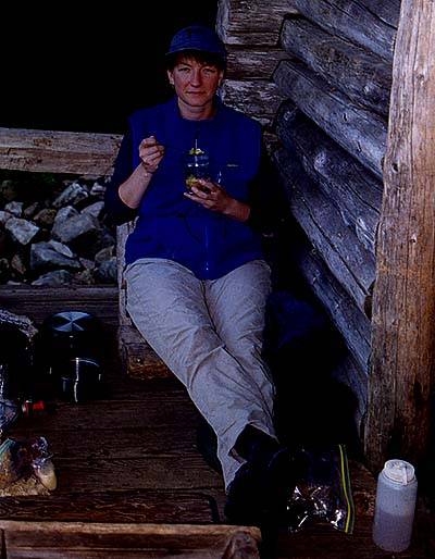
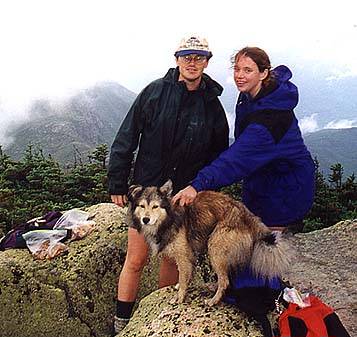
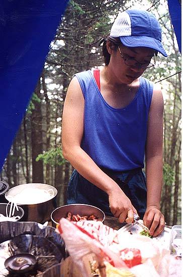
 We headed back to the campsite, wondering about Ching, Andrew, and Dave. They showed
up around 2:30, dropped pack and proceeded to do the Bonds, very determined peakbaggers
that they are. They didn't really get any views, but they accomplished their goals.
We settled into our tents for a nap in the rain. By the time they got
back we had set up the kitchen area at one of our tent platforms and
Ching prepared a scrumption Pad Thai for dinner. It was
devoured by us hungry hikers. Later, we settled into a slightly damp evening and an
early bed.
We headed back to the campsite, wondering about Ching, Andrew, and Dave. They showed
up around 2:30, dropped pack and proceeded to do the Bonds, very determined peakbaggers
that they are. They didn't really get any views, but they accomplished their goals.
We settled into our tents for a nap in the rain. By the time they got
back we had set up the kitchen area at one of our tent platforms and
Ching prepared a scrumption Pad Thai for dinner. It was
devoured by us hungry hikers. Later, we settled into a slightly damp evening and an
early bed.
Day 3 - The Twins and Lightning
Map of day 3.
Elevation chart of day 3.
We had lots of different agendas for the last day. Ching and Andrew needed to be
at an afternoon party down near Worchester, so they took off early and headed back
along the Twinway, the way they came in. Brenda and I and the other Dave were going
out via the Twins to grab two more 4000'ers and hopefully get some more views. Ed
and Kathy were going to sleep in, then follow our tracks. We were supposed to drive
back to Zealand, pick up Ed's truck and drop it off back at the North Twin trailhead.
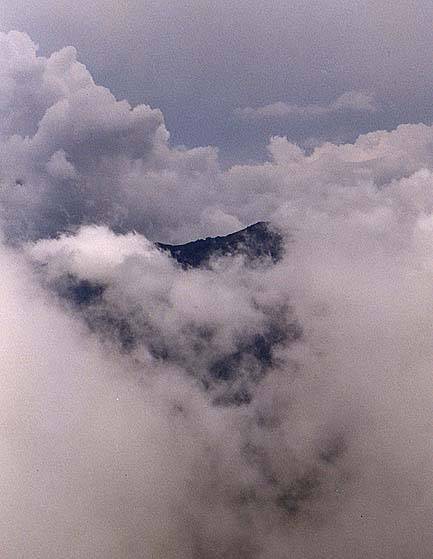
We were hearing some thunder as we crossed the two summits of Guyot and we were getting
a bit worried about our safety. Once we cleared the open areas and got back in the
woods, the rain picked up and the thunder sounded directly overhead. We stopped, took
off our packs, and found some cover and waited it out. It was a bit sketchy at times,
but the storm passed without incident.
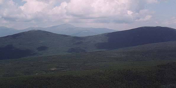
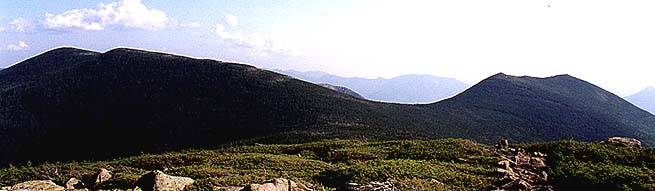
 When we did get to the summit of South Twin, it was pretty cloudy. But after a few
minutes some of the clouds cleared off and we spend some time
drying out and enjoying the partial views. Then we pushed off towards North Twin,
enjoying occasional views and a lovely walk in the woods. We only saw a few people
along the ridge, and none on either summit. The summit ledges
of North Twin provided a great place for lunch. Occasionally the ridges would come
out of the clouds for some spectacular views. The rest of the
trip was steady and long, a gradual trail once we got past the steep upper ridges
of North Twin. A good chunk of the bottom of the trail is along a river and made for
a nice end to the three day journey. We did all the car swaps and headed out by 4:00,
and by then the summits were clearing.
When we did get to the summit of South Twin, it was pretty cloudy. But after a few
minutes some of the clouds cleared off and we spend some time
drying out and enjoying the partial views. Then we pushed off towards North Twin,
enjoying occasional views and a lovely walk in the woods. We only saw a few people
along the ridge, and none on either summit. The summit ledges
of North Twin provided a great place for lunch. Occasionally the ridges would come
out of the clouds for some spectacular views. The rest of the
trip was steady and long, a gradual trail once we got past the steep upper ridges
of North Twin. A good chunk of the bottom of the trail is along a river and made for
a nice end to the three day journey. We did all the car swaps and headed out by 4:00,
and by then the summits were clearing.
Back to White Mountains home page