
This trip report has the elements of a mystery. Play along! Win valuable prizes! The last time I'd been up Carrigain was on a snowy Nov 1 with several folks who were finishing their 4000'ers, I was finishing my second round. I had told them to save Carrigain because of the great views up top, the perfect place to finish. Alas, that day was snowy, cold, and windy; we spent about 5 minutes total up top and saw nothing but white. This day was looking a little better, a bit hazy, but nice sunshine. Only a small group this time, my friends Ching & Andrew, who finished up their list on that snowy day. We drove up from Boston in their car, taking a bit of late start, not hitting the trailhead until after 10:00. I've been after the two of them to carry more water when hiking, they usually only carry 1 liter each, today they were carrying two liters plus Andrew had a big bottle of Gatorade. Clue #1 Also, Ching has a huge problem with black fly and mosquito bites, but today she was asking about using her bug netting shirt rather than DEET. Clue #2
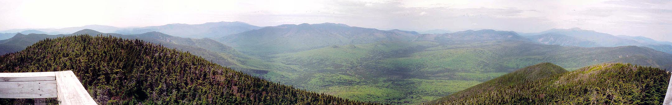
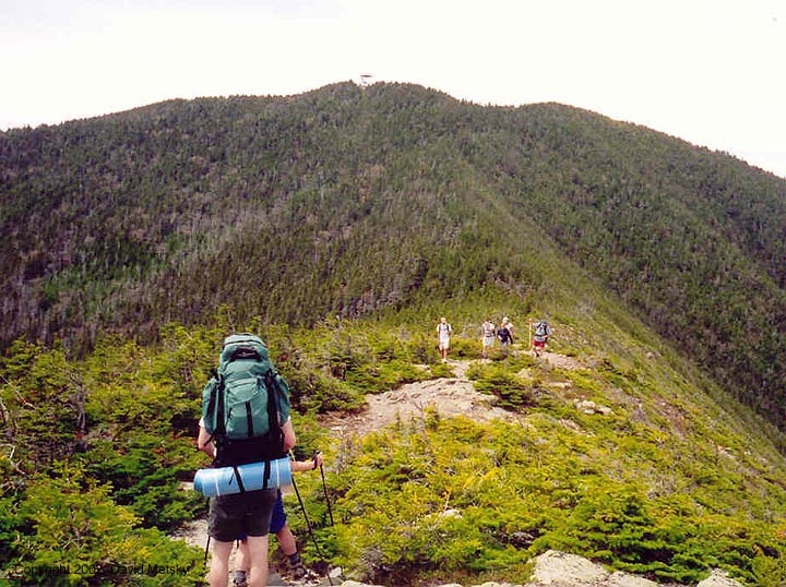
The bottom section of the trail is a nice walk in the woods. There are a few stream crossings, and a couple we met just ran across one, they got a little wet but it was much quicker than our picking our way across on rocks and logs. Eventually the trail starts climbing and there are a series of switchbacks to gain some elevation and reach some cooler air. There are a few little views of Carrigain Notch, which can make for a nice loop with the Desolation trail up the backside of Carrigain. Not this day. There's also one section of trail that has slid, nothing too nasty but it looks a bit of a mess. Normally, Andrew flies way ahead, he is a very fast hiker. But on this trip I was in the lead, Andrew and Ching were bringing up the rear. Clue #3 There were lots of hikers coming down, our late start meant we would have to share the summit with fewer people, but also get out later. No worries, plenty of daylight. Finally we came out on Signal Ridge, an open ridgetop that gives some great views over the eastern Pemi and also of the summit and lookout tower of Carrigain.

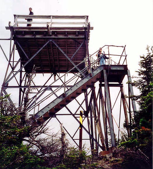
We rested and ate. No real rush, the longer we waited the fewer folks would be up top. On the previous hike we could barely follow the trail up here, today you could see it all the way to the summit. Eventually we pushed on, it's only another half mile to the top, again a few switchbacks and there we were. There were a handful of folks up top, all resting on the observation tower in the sun and wind. One pair had hauled up a 12 pack of Magic Hat (in bottles) and were settling in for the night. The rest were dayhikers like us, just chilling out in the glorious mountain setting. We must have spent an hour up there, chatting and eating, a very social gathering. Eventually we decided to pack up and head on down. Laying out in the sun was making us sleepy.


As is usual on these hikes, the trip down is just one big blur. Soon we were back on Signal Ridge, then into the switchbacks, then down on the flats, and finally the big stream crossings. We were pretty tired by the time we got back to the car, Ching in particular was pretty beat. Clue #4 We stopped at the Common Man for dinner, now I've forgotten which one, Ashland or Lincoln. No matter, same great food. So, did you figure out the mystery? I certainly didn't, even though I had all the clues in front of me. For the answer, read this.