Presidential Traverse - June 18, 1995
The summer was starting and a bunch of friends decided to do a one-day
Presidential Traverse around the summer solstice. It's a very seasonal
thing to do, don't you know. Most of us had done a Traverse, although
I think I was the only one to who'd done a one-day trip before.
 We met in Crawford Notch the night before
the hike, leaving my car there. We put another car at the Cog Railroad base station and drove around
to a cabin near the trailhead in the final vehicle. There were five
of us; 3 Dave's, Kathy, and Lelia, plus
Mugs the Wonder dog.
We met in Crawford Notch the night before
the hike, leaving my car there. We put another car at the Cog Railroad base station and drove around
to a cabin near the trailhead in the final vehicle. There were five
of us; 3 Dave's, Kathy, and Lelia, plus
Mugs the Wonder dog.
 The morning of the hike we woke up at 5:00 AM, had a traditional
breakfast of OJ, rhubarb pie with ice
cream, eggs, and leftover scalipini sauce. We drove the 300 yards
to the trailhead since we couldn't leave the car at the cabin and hit
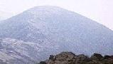
the trail just after 6:00 AM. The weather was hot and humid, even
early in the morning, and we knew that we weren't in for spectacular
views. We took the Valley Way trail up to
Madison Springs Hut but presented with
our first challange we wimped out and didn't go up
Mt. Madison. It was about 8:00 when
we arrived and we knew there was a long day ahead of us.
The morning of the hike we woke up at 5:00 AM, had a traditional
breakfast of OJ, rhubarb pie with ice
cream, eggs, and leftover scalipini sauce. We drove the 300 yards
to the trailhead since we couldn't leave the car at the cabin and hit
the trail just after 6:00 AM. The weather was hot and humid, even
early in the morning, and we knew that we weren't in for spectacular
views. We took the Valley Way trail up to
Madison Springs Hut but presented with
our first challange we wimped out and didn't go up
Mt. Madison. It was about 8:00 when
we arrived and we knew there was a long day ahead of us.
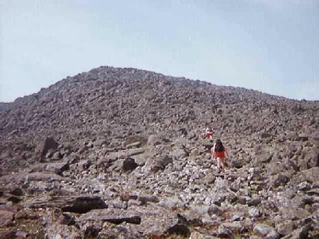
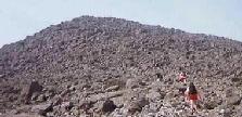 Next stop was Mt. Adams, so we continued up
the Airline trail over the
rough terrain towards the rocky
summit cone. We rested at the
summit in the shelter of the rocks, grabbed
some water and started our first descent of the day. This was a test
of the knees, and everyone was anxious about bad knees forcing us to
bail early. We dropped down to
Thunderstorm Junction, a large cairn at the
meeting point of several trails and headed south without stopping. At
t-storm I met some folks who had left Madison Hut before we did but
didn't go over the summit of Adams. They we impressed with our speed
even though we were not hiking that fast.
Next stop was Mt. Adams, so we continued up
the Airline trail over the
rough terrain towards the rocky
summit cone. We rested at the
summit in the shelter of the rocks, grabbed
some water and started our first descent of the day. This was a test
of the knees, and everyone was anxious about bad knees forcing us to
bail early. We dropped down to
Thunderstorm Junction, a large cairn at the
meeting point of several trails and headed south without stopping. At
t-storm I met some folks who had left Madison Hut before we did but
didn't go over the summit of Adams. They we impressed with our speed
even though we were not hiking that fast.
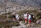 Our route was the Gulfside trail, which connects all the northern
Presidentials. It travels across a
relatively flat section between
the various summits of Adams, then drops down
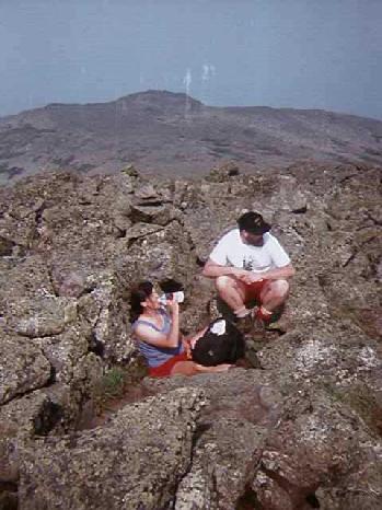
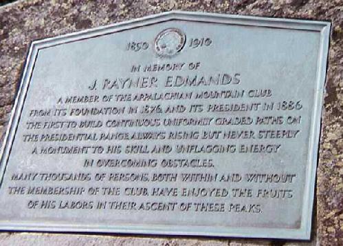
to Edmonds Col. We took a bit of a rest there next to the
plaque, grabbed
some gorp and a few PowerBars, and tanked up
on water. The original plan had been for Lelia to head back down the
Randolf Path with Mugs, but he was doing fine
so we continued on with him. With a quick look back
we continued south.
Our route was the Gulfside trail, which connects all the northern
Presidentials. It travels across a
relatively flat section between
the various summits of Adams, then drops down
to Edmonds Col. We took a bit of a rest there next to the
plaque, grabbed
some gorp and a few PowerBars, and tanked up
on water. The original plan had been for Lelia to head back down the
Randolf Path with Mugs, but he was doing fine
so we continued on with him. With a quick look back
we continued south.
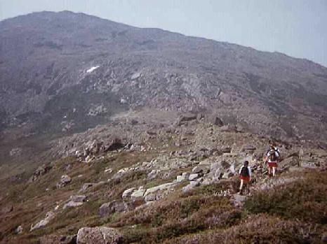
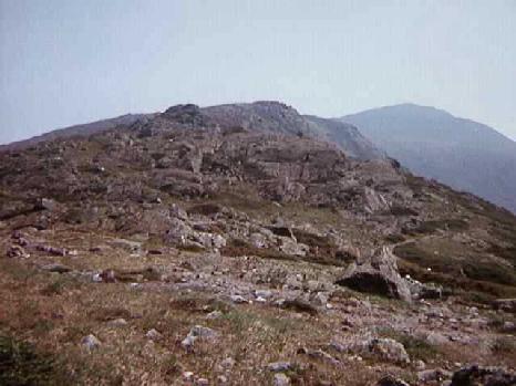
 The climb up from Edmonds Col to Mt.
Jefferson is pretty major but we were refreshed by passing by
the only snow we encountered all day. After
a few snowballs near the solstice we made it to the
summit and dropped quickly to
Montecello Lawn. We came to our second
decision point, to go over or around Mt. Clay,
and, like a good group we decided to split up, with Dave and Kathy
going around while Dave, Lelia, Mugs, and I headed over. The many
summits of Clay afford lovely views north back
from where we came and into the Great Gulf leading
up to Mt. Washington.
The climb up from Edmonds Col to Mt.
Jefferson is pretty major but we were refreshed by passing by
the only snow we encountered all day. After
a few snowballs near the solstice we made it to the
summit and dropped quickly to
Montecello Lawn. We came to our second
decision point, to go over or around Mt. Clay,
and, like a good group we decided to split up, with Dave and Kathy
going around while Dave, Lelia, Mugs, and I headed over. The many
summits of Clay afford lovely views north back
from where we came and into the Great Gulf leading
up to Mt. Washington.
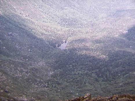
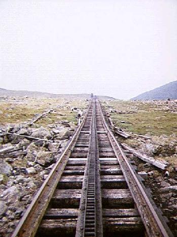
 From Clay we saw two trains of the Cog Railroad
running over Jacob's Ladder, the highest and
steepest trestle on the line. We also got some hazy views
over the Great Gulf
and down onto the floor to see Spaulding Lake.
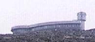
Then the trail starts climbing in ernest, crossing the
tracks and heading up towards the
summit buildings. After one last big slog
we hit the summit and took a well deserved rest
among the tourists, cars, and machinery. It was approximately 1:00 PM.
From Clay we saw two trains of the Cog Railroad
running over Jacob's Ladder, the highest and
steepest trestle on the line. We also got some hazy views
over the Great Gulf
and down onto the floor to see Spaulding Lake.
Then the trail starts climbing in ernest, crossing the
tracks and heading up towards the
summit buildings. After one last big slog
we hit the summit and took a well deserved rest
among the tourists, cars, and machinery. It was approximately 1:00 PM.
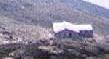 We didn't feel like eating lunch up amongst the crowds so we headed on
south, hoping to find a breezy spot below the summit cone. Just past
the junction with the Westside trail we found our spot with a nice view of
Lakes of the Clouds Hut and
the southern Presidentials. We ate, approximately eight hours after
we started, with sailplanes cruising overhead and the sound of the
Cog Railroad occasionaly piercing the air. Lunch was done (and many liters
of water consumed) and we started the psychological second half of
our journey. It was mostly downhill (physically and mentally) from here.
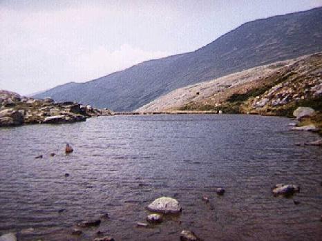
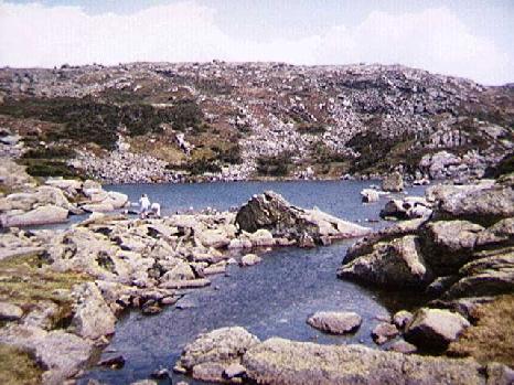
The trail winds between the
upper and lower
lakes, past the acid rain research station and
arrives at the hut.
We didn't feel like eating lunch up amongst the crowds so we headed on
south, hoping to find a breezy spot below the summit cone. Just past
the junction with the Westside trail we found our spot with a nice view of
Lakes of the Clouds Hut and
the southern Presidentials. We ate, approximately eight hours after
we started, with sailplanes cruising overhead and the sound of the
Cog Railroad occasionaly piercing the air. Lunch was done (and many liters
of water consumed) and we started the psychological second half of
our journey. It was mostly downhill (physically and mentally) from here.
The trail winds between the
upper and lower
lakes, past the acid rain research station and
arrives at the hut.
 The AMC Construction Crew (CC) was at the hut installing a wind
generator to back up the solar cells. We noticed a similar one
over at Madison and had a nice discussion with the CC guy about rock
bars, helicopters, and life on the hill. After filling up water bottles
for the last time, we headed out again. We had agreed that we were
going to wimp out again and skip Mt Monroe
since we'd all been up it and we were feeling the heat. The Crawford
path took us around Monroe, past Mt Franklin
and onto the final stages of the trip. The
views were getting very hazy
as the afternoon heat was getting us down. Dave and Lelia, with Mugs, headed
over Mt Eisenhower and we decided to push on ahead
so we could go do the car dance, picking up the one at Appilachia and
the one at the Cog base. We could see Dave and Lelia coming down
from the summit of Eisenhower as we reached
Pierce and started the big drop down
to Crawford Notch. This was the most
painful part of the trip. Our feet were sore and the trail drops
around 2000' feet in three miles, but the end was in sight. We reached
the road at 7:00 PM, thirteen hours total. I got my car at the cog
and picked up Dave and Lelia who were down by then. Even Mugs was dead
tired. Dave and Kathy had driven the Jefferson Notch road to pick up
the car at Appilachia and met us in Twin Mountain for pizza, a fine end
to an exhausting and enjoyable day.
The AMC Construction Crew (CC) was at the hut installing a wind
generator to back up the solar cells. We noticed a similar one
over at Madison and had a nice discussion with the CC guy about rock
bars, helicopters, and life on the hill. After filling up water bottles
for the last time, we headed out again. We had agreed that we were
going to wimp out again and skip Mt Monroe
since we'd all been up it and we were feeling the heat. The Crawford
path took us around Monroe, past Mt Franklin
and onto the final stages of the trip. The
views were getting very hazy
as the afternoon heat was getting us down. Dave and Lelia, with Mugs, headed
over Mt Eisenhower and we decided to push on ahead
so we could go do the car dance, picking up the one at Appilachia and
the one at the Cog base. We could see Dave and Lelia coming down
from the summit of Eisenhower as we reached
Pierce and started the big drop down
to Crawford Notch. This was the most
painful part of the trip. Our feet were sore and the trail drops
around 2000' feet in three miles, but the end was in sight. We reached
the road at 7:00 PM, thirteen hours total. I got my car at the cog
and picked up Dave and Lelia who were down by then. Even Mugs was dead
tired. Dave and Kathy had driven the Jefferson Notch road to pick up
the car at Appilachia and met us in Twin Mountain for pizza, a fine end
to an exhausting and enjoyable day.
Back to White Mountains home page