
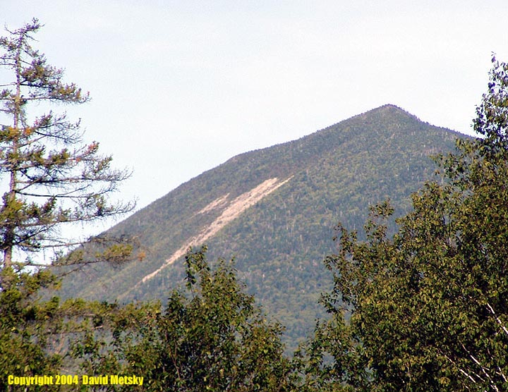
On the North Slide
North Tripyramid - 4140' Middle Tripyramid - 4110'
The Tripyramids have three summits, but only the North and Middle peaks count as official 4000 footers. The usual dayhike is an 11 mile clockwise loop, starting at the Livermore trailhead, near the center of Waterville Valley. The first 3.6 miles are on the Livermore Road which is gated at the trailhead. The Mount Tripyramid Trail climbs up the north slide a steep, bare slide that is difficult and dangerous in bad weather. An alternative route to bypass the slide is to continue on the Livermore Road to the Scaur Ridge trail which adds 1 mile to the loop. The descent is down the south slide which has more loose rock and scree, back to the Livermore Road. There are two routes up from the Kanc, Sabbaday Brook and Pine Bend Brook trails. A loop with a short road walk between them is a nice 11 mile loop.
The north slide was created in 1885 during a heavy rain, the south in 1869. The best views are from near the top of the north slide, with some nice views near the summit of Middle Peak.
Trailheads
- Livermore Road - Drive towards the ski area, branching right towards Tripoli Road below the parking areas. Take this for .8 miles and turn right on Tripoli Road, the parking lot is on your left. A WMNF parking pass is needed.
- Sabbaday Falls Picnic Area - This large lot is 3.3 miles west of the Bear Notch road intersection on the Kanc (NH Rt 112). A WMNF parking pass is needed.
- Pine Bend Brook trailhead - There is no parking lot here, park along the side of the highway. The trailhead is 1 mile east of Sabbaday Falls Picnic Area. A WMNF parking pass is needed.